angola 1 1 400 000

Angola 1:1 400 000
This map appears in the map series world mapping project ™ in travel expertise. Characteristic is the high-quality, clear and modern cartographic representation. Contour lines with elevation Coloured elevation levels Classified road network with distances Places of interest Detailed local index
1423 Руб.
НАЙТИ ЕЩЕ
Italien. Superatlas 1:150 000 / 1:400 000
Italien. M 1:150 000 / 1:400 000. Крепление: двойная евроспираль.
1660 Руб.
НАЙТИ ЕЩЕ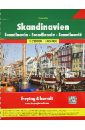
Scandinavia. SuperAtlas 1:250 000-1:400 000
Touristische Informationen, Ortsregister mit Postleitzahlen, Cityplane, Stra?enverzeichnis, Campinplatze, Entfernungen in km. Laufzeit bis 2014 16, 471, 64 S. m. zahlr. farb. Ktn. u. Pln. 30 cm 1850g 1:250.000 u. 1:400.000 Spiralbindung , in englischer, franzosischer, niederlandischer / flamischer, deutscher, norwegischer, schwedischer, danischer und finnischer Sprache. Крепление: двойная евроспираль.
2288 Руб.
НАЙТИ ЕЩЕ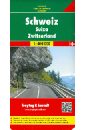
Switzerland. 1:400 000
A detailed road map of Switzerland at a scale of 1:400,000 (1" to 6 miles).The road network is classified along with route numbers and distances. Map details include railways, airports, gas stations on the Autobahn, scenic and tourist routes and scenic viewpoints and places of interest. Cantons are outlined. The index book of communities includes postal codes and center city plans of Basel, Bern, Geneva, and Zurich. The legend is in English, Italian, French and German.
937 Руб.
НАЙТИ ЕЩЕ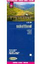
Scotland 1:400 000
This map appears in the map series world mapping project in travel expertise. Characteristic is the high-quality, clear and modern cartographic representation. Contour lines with elevation Coloured elevation levels Classified road network with distances Places of interest Detailed local index GPS capability by longitude and latitude UTM grid.
937 Руб.
НАЙТИ ЕЩЕ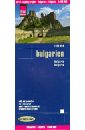
Bulgaria 1:400 000
This map appears in the map series world mapping project in travel expertise. Characteristic is the high-quality, clear and modern cartographic representation. Contour lines with elevation Coloured elevation levels Classified road network with distances Places of interest Detailed local index GPS capability by longitude and latitude UTM grid
1423 Руб.
НАЙТИ ЕЩЕ
Bulgaria. 1:400 000
Explore Bulgaria with this Freytag & Berndt road map. The best way to plan your trip, prepare your itinerary, and to travel independently in this country.
937 Руб.
НАЙТИ ЕЩЕ
Spain-Portugal-Europa 1:400 000 / 1:3.500 000
Spain-Portugal-Europa. M 1:400 000 / 1:3.500 000. Крепление: двойная евроспираль.
2682 Руб.
НАЙТИ ЕЩЕ
Colombia. Kolumbien 1:1 400 000
This map appears in the map series world mapping project in travel expertise. Characteristic is the high-quality, clear and modern cartographic representation. Contour lines with elevation Coloured elevation levels Classified road network with distances Places of interest Detailed local index GPS capability by longitude and latitude UTM grid
1164 Руб.
НАЙТИ ЕЩЕ
England - Wales 1:400 000
Explore England and Wales with this Freytag & Berndt double-sided road map. The best way to plan your trip, prepare your itinerary, and to travel independently in these two countries of Great Britain. Place name index and inset maps of London in a booklet. Touristic information: airports, places of interest, view-points, lighthouses, castles, manor-houses, religious buildings, archaeological sites, accommodation, camping sites, monuments, golf courses. The legend is in English, French, German, Italian, Dutch, Spanish, Czech, Slovak, Hungarian and Polish.
1164 Руб.
НАЙТИ ЕЩЕ
Hungary. Ungarn 1:400 000
Touristische Informationen. Ortsregister mit Postleitzahlen. Entfernungen in km.
548 Руб.
НАЙТИ ЕЩЕ
Italien. Nord. 1: 400 000
This map appears in the map series world mapping project in travel expertise. Characteristic is the high-quality, clear and modern cartographic representation. Contour lines with elevation Coloured elevation levels Classified road network with distances Places of interest Detailed local index GPS capability by longitude and latitude UTM grid
1164 Руб.
НАЙТИ ЕЩЕ
Атлас Москвы и Московской области (4 карты в 1 атласе)
Атлас содержит: Центр Москвы - 1:12 000 Вся Москва - 1:39 000 Ближнее Подмосковье - 1:200 000 Московская область - 1:400 000 Новые автодороги, схемы организации движений, Москва с домами, схемы пригородного сообщения, справочная информация автомобилиста.
578 Руб.
НАЙТИ ЕЩЕ
Атлас автомобильных дорог. Россия. Выпуск 1. 2017 + карты городов
Автомобильные дороги от Калининграда до Находки. Содержит: - карты автомобильных дорог масштаба 1:700 000; - карты автомобильных дорог масштаба 1:1 400 000; - карты автомобильных дорог масштаба 1:2 800 000; Главный редактор: В. Н. Пейхвассер.
924 Руб.
НАЙТИ ЕЩЕ
Атлас автомобильных дорог России, СНГ, Прибалтики 2010
В Атласе вы найдете: - схему размещения карт; - таблицы расстояний; - условные обозначения; - карты автомобильных дорог масштаба 1:700 000; - карты автомобильных дорог масштаба 1:1 400 000; - карты автомобильных дорог масштаба 1:2 800 000; - указатель населенных пунктов.
219 Руб.
НАЙТИ ЕЩЕ
Атлас автомобильных дорог России, СНГ, Прибалтики 2010
В Атласе вы найдете: - схему размещения карт; - таблицы расстояний; - условные обозначения; - карты автомобильных дорог масштаба 1:700 000; - карты автомобильных дорог масштаба 1:1 400 000; - карты автомобильных дорог масштаба 1:2 800 000; - указатель населенных пунктов.
390 Руб.
НАЙТИ ЕЩЕ