sicily 1 200 000

Sicily 1:200 000
This map appears in the map series world mapping project ™ in travel expertise. Characteristic is the high-quality, clear and modern cartographic representation. - Contour lines with elevation - Coloured elevation levels - Classified road network with distances - Places of interest - Detailed local index - GPS longitude and latitude capability by - UTM mark on the edge of the map - Legend in four languages (Ger, Engl, French , Span..)
743 Руб.
НАЙТИ ЕЩЕ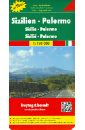
Sicily - Palermo. 1:150 000
Explore Sicily with this Freytag&Berndt double-sided road map. The best way to plan your trip, prepare your itinerary, and to travel independently in this part of Southern Italy. Top10 Tips: This map includes a Top10 of most interesting sights. M 1 : 150 000.
750 Руб.
НАЙТИ ЕЩЕ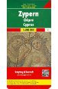
Cyprus. 1:200 000
Explore Cyprus with this Freytag&Berndt road map. The best way to plan your trip, prepare your itinerary, and to travel independently on this island in the Mediterrenean. Touristic information: museums, castles, monasteries, churches, mosques, camping sites, caves, archaeological sites, and several inset maps of main cities. The legend is in 4 languages (English and Greek included). Place names are indicated in both Roman and Greek scripts.
937 Руб.
НАЙТИ ЕЩЕ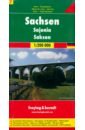
Sachsen 1:200 000
These city maps are produced by one of Europe's leading map publishers. They vary in scale by city but include a wealth of detail on tourist attractions, transportation and culture.
540 Руб.
НАЙТИ ЕЩЕ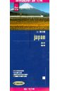
Japan. 1:1 200 000
This map appears in the map series world mapping project in travel expertise. Characteristic is the high-quality, clear and modern cartographic representation. Contour lines with elevation Coloured elevation levels Classified road network with distances Places of interest Detailed local index
583 Руб.
НАЙТИ ЕЩЕ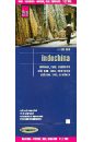
Indochina. 1:1 200 000
This map appears in the map series world mapping project in travel expertise. Characteristic is the high-quality, clear and modern cartographic representation. Contour lines with elevation Coloured elevation levels Classified road network with distances Places of interest Detailed local index
1164 Руб.
НАЙТИ ЕЩЕ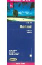
Thailand 1: 1 200 000
This map appears in the map series world mapping project in travel expertise. Characteristic is the high-quality, clear and modern cartographic representation. Contour lines with elevation Coloured elevation levels Classified road network with distances Places of interest Detailed local index GPS capability by longitude and latitude UTM grid
937 Руб.
НАЙТИ ЕЩЕ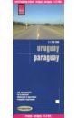
Uruguay. 1:1 200 000
This map appears in the map series world mapping project in travel expertise. Characteristic is the high-quality, clear and modern cartographic representation. Contour lines with elevation Coloured elevation levels Classified road network with distances Places of interest Detailed local index GPS capability by longitude and latitude UTM grid
1164 Руб.
НАЙТИ ЕЩЕ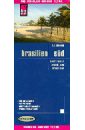
Brazil, South 1:1 200 000
This map appears in the map series world mapping project ™ in travel expertise. Characteristic is the high-quality, clear and modern cartographic representation. - Contour lines with elevation - Coloured elevation levels - Classified road network with distances - Places of interest - Detailed local index - GPS capability by longitude and latitude - Legend in four languages (Ger., Engl, French Polynesia, Span).
1276 Руб.
НАЙТИ ЕЩЕ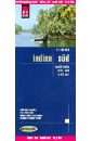
India, South. 1:1 200 000
This map appears in the map series world mapping project ™ in travel expertise. Characteristic is the high-quality, clear and modern cartographic representation. Contour lines with elevation Coloured elevation levels Classified road network with distances Places of interest Detailed local index
1231 Руб.
НАЙТИ ЕЩЕ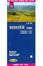
Mosambik. Malawi. 1:1 200 000
Carte routiere detaillee editee par Reise Know How en 2012 qui couvre a la fois le Mozambique et le Malawi. En encart, les plans des villes de Lilongwe et Maputo ainsi qu'une carte detaillee de la region autour de Maputo. Index des villes egalement inclus. Cette carte detaillee est indechirable et impermeable.
676 Руб.
НАЙТИ ЕЩЕ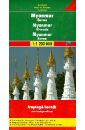
Myanmar. Burma. 1:1 200 000
High quality road maps with place name index. In many countries these are simply the best maps available. Scales vary according to the size of the country. Index is in several languages.
548 Руб.
НАЙТИ ЕЩЕ
Naher Osten. 1:1 200 000
Diese Landkarte erscheint in der Landkartenserie world mapping projec bei Reise Know-How. Kennzeichnend ist die hochwertige, klare und moderne kartografische Darstellung. - Hohenlinien mit Hohenangaben - Farbige Hohenschichten - Klassifiziertes Straennetz mit Entfernungsangaben - Sehenswurdigkeiten - Ausfuhrlicher Ortsindex - GPS-Tauglichkeit durch Langen-und Breitengrade - UTM-Gitter
1276 Руб.
НАЙТИ ЕЩЕ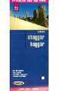
Ahaggar. Hoggar 1:200 000
This map appears in the map series world mapping project in travel expertise. Characteristic is the high-quality, clear and modern cartographic representation. Contour lines with elevation Coloured elevation levels Classified road network with distances Places of interest Detailed local index GPS capability by longitude and latitude UTM grid
1231 Руб.
НАЙТИ ЕЩЕ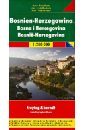
Bosnia-Hercegovina. 1:200 000
Explore Bosnia Hercegovina with this Freytag&Berndt double-sided road map. The best way to plan your trip, prepare your itinerary, and to travel independently in this country.
1044 Руб.
НАЙТИ ЕЩЕ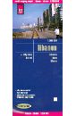
Ливан. Карта. 1:200 000
Diese Landkarte erscheint in der Landkartenserie world mapping projec bei Reise Know-How. Kennzeichnend ist die hochwertige, klare und moderne kartografische Darstellung. - Hohenlinien mit Hohenangaben - Farbige Hohenschichten - Klassifiziertes Straennetz mit Entfernungsangaben - Sehenswurdigkeiten - Ausfuhrlicher Ortsindex - GPS-Tauglichkeit durch Langen-und Breitengrade - UTM-Gitter
1007 Руб.
НАЙТИ ЕЩЕ